by CHARLIE SCHULER
I’m not talking just any stream here, I’m talking about the GULF STREAM. It is the granddaddy of all streams. I’ll bet you didn’t know that the Gulf Stream carries more water than all the world’s rivers combined. That’s huge! It averages 62 miles wide and it’s 3900’ feet deep. The average temperature is 80 degrees at the surface. Imagine a body of water this big moving north at a speed of 4 to 5.6 mph.
This is awesome and something to be considered when you are a sailor. Not so much when you are in a power vessel, because you can make the 62 miles rather quickly. But sailors tend to spend more time on the water to make the same 62 miles. Sailboat speed is limited by design.
Sailboats normally have a displacement hull. This means that they push the water out of the way as they move forward. The maximum speed of a sailboat under sail is determined by the length of the waterline. Confused? Don’t be. Our sailboat was 42’ and had a maximum speed of 8.1 mph. That is normally the fastest we can go without considering the effect of the water.

The area we are talking about here is the body of water between Florida and the Bahamas. Let’s say Fort Lauderdale and Chub Cay. By the way, the locals pronounce Cay, Kee rather than Kay. If you’re going to sail to the Bahamas from the states you are going to cross the Gulf Stream. And if your sailboat is only making 4 to 8 mph on the average you can see the problems that might come up here. So sailors tend to hole up someplace till the weather is favorable. You don’t want to be crossing the stream when the wind is blowing from the north; like after a cold front passes. A wind from the north blowing over a body of water moving north can make for very nasty conditions. The confused seas can go to 25’ high and more in no time. This is tough on any boat and crew.
So the thing to do is find a nice spot and wait on the weather. It’s kinda fun actually. You get to meet other boaters who are also waiting on the weather and it gives you the opportunity to explore your location. We crossed out of Fort Lauderdale a number of times. We were heading for Chub Cay to clear customs and then south through the Exumas.
Don’t arrive at night if you can avoid it. First of all, the waters of the Bahamas are not clearly marked. I remember one time we were advised to head south and turn to a heading of 265 true when you see the blue cottage and the pink cottage in a line. We found the blue cottage but never did see a pink one. We later found out they painted it yellow. But, with Marianne on the bow we cleared the coral safely. Two things you should remember; GPS was not available in the early 90’s, and we saw at least one boat sink each time we were there.

With all that being said, we left Fort Lauderdale about 2 am. The wind was from the west, and we thought we could make a quick trip. WRONG! The front passed quicker than we thought and the wind shifted to the north. As predicted, the seas built quickly. We had to shorten the sail to match the increased wind speed. It was a rough ride but our boat was designed for rough conditions.
I remember hearing on the VHF radio a lady saying that her husband was tossed around and broke his arm. VHF means Very High Frequency. It is the typical radio used on the water. Sixteen is the calling and monitoring channel. All boats are required to monitor this channel and switch to a working channel for conversation.
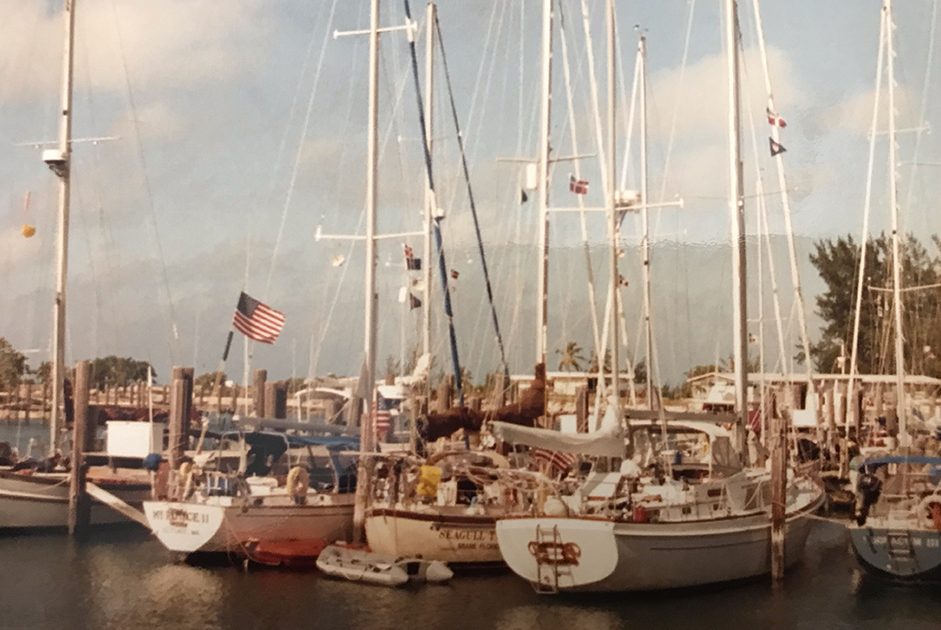
We had a successful crossing and pulled into Chub Cay. The first thing we did was to raise our yellow quarantine flag. No one is to leave the vessel until we clear customs in the country we are in. After clearing in, we would raise the flag of the country on our starboard (right) spreader as a sign of respect.
Put the Bahamas on your do list. It is worth the trip. The people, water and weather are fantastic. Their flag which is black, yellow, and blue represents the people, sun, and water.
We love it!
